Asia (see also Eurasia)
Asia
Asia, Central
Asia, East
Asia, South
Asia, Southeast
Afghanistan
Armenia
Borneo
Burma
Cambodia
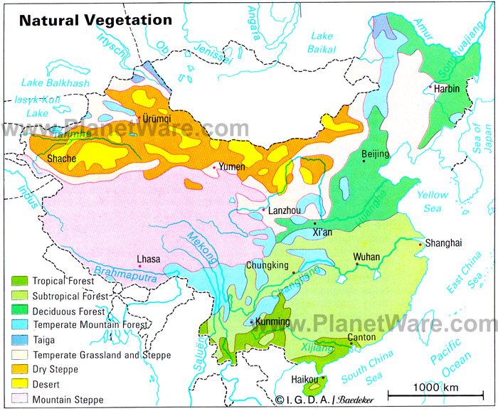
China
- Tibet
India
- Goa
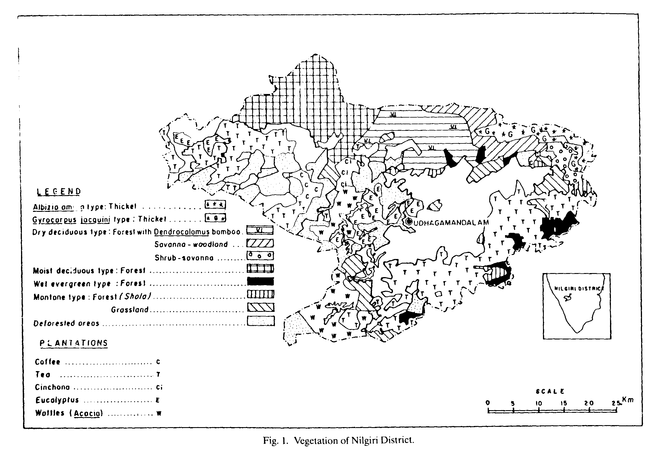
- Nilgiri District
- India, South
- Maharashtra
- Western Ghats
Indonesia
- Irian Jaya
- Jambi Province
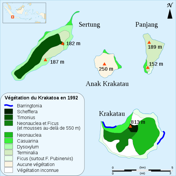
- Krakatoa
- Sumatra
Iraq
Israel
Japan
- Hokkaido
Kazakhstan
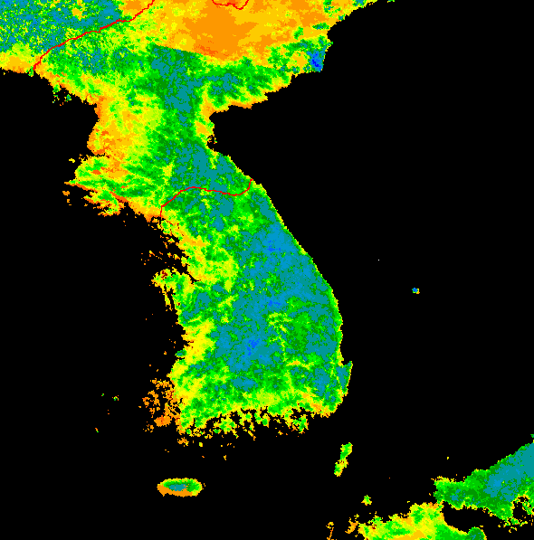
Korea
Malaysia
Mekong River Valley
Mongolia
Philippines
Sri Lanka
Thailand
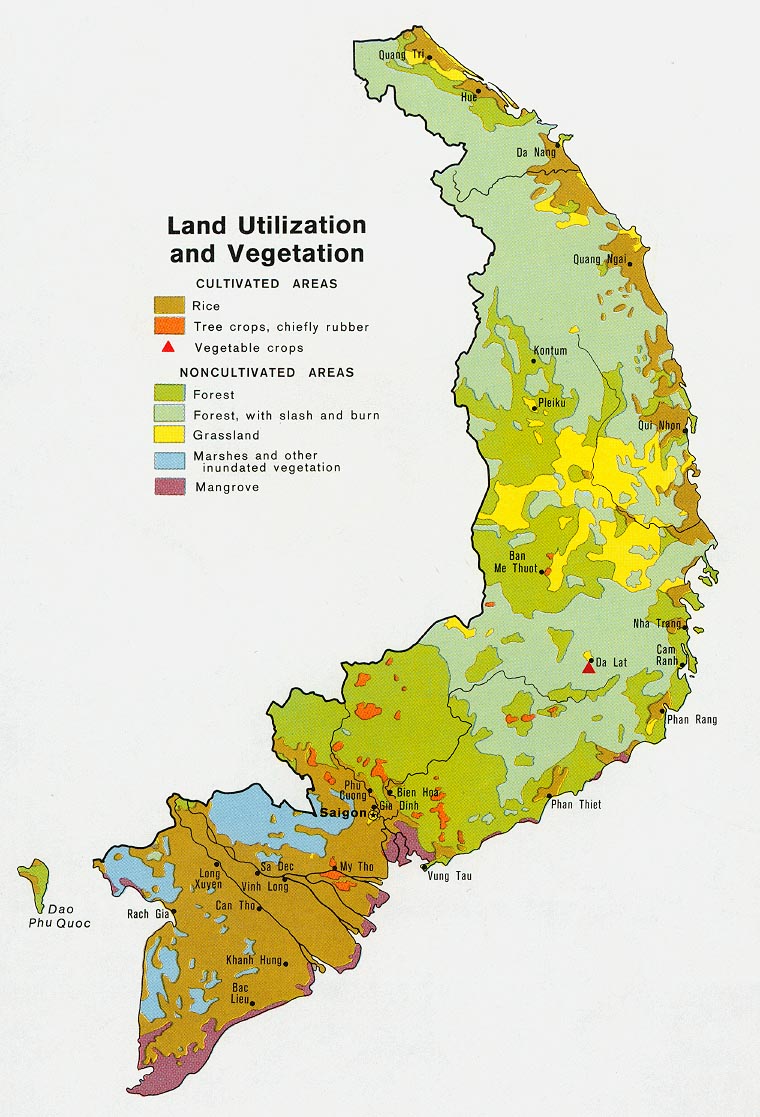
Vietnam
Original title of website: Checklist of Online Vegetation and Plant Distribution Maps
Compiled by Claire Englander (1996-2013). Founding co-compiler Philip Hoehn (1996-2009). With thanks to Phyllis Bischof, Ed Colijn, Rheal Coupal, John Creaser, Larry Cruse, Joe Dalton, Hugh Eva, Vic Fazio, Xavier Font Castell, Steve Glenn, Lawrence Hislop, Robert Hoare, Michael Jennings, Stephen Killeffer, Brian Klinkenberg, Raino Lampinen, Andrew Lillie, David MacDevette, Philippe Mayaux, Justin Moat, Jim Moore, Tom Owens, Scott Sundberg, Thomas A. Stone, Urs-Beat Brändli, Rob Waller, Hugh D.Wilson and George Wooten.
Maps are no longer being added to or deleted from these lists - the lists are maintained in this guide for archival purposes only.
If you find a broken link, you can search for the link in the Wayback Machine to see if an archived copy of the web page exists.
You can also report broken links via email.
![Thailand : [Forests]](http://homepage.univie.ac.at/Christian.Puff/_images/Thailand_veg.jpg)