Europe (see also Eurasia)
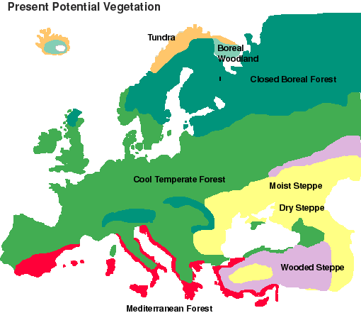
Europe
Albania
Alps
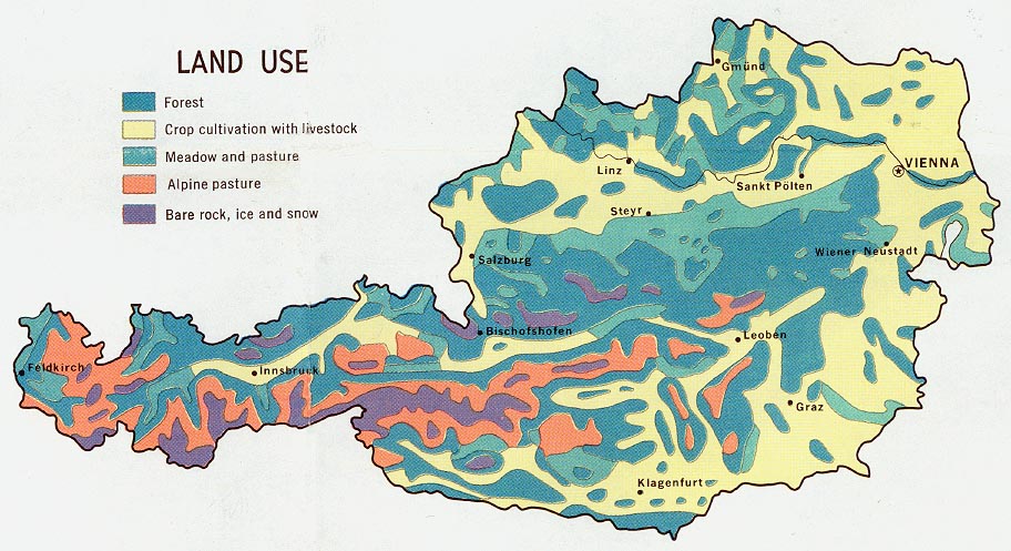
Austria
Baltic Sea
Barents Sea Region
Belgium
British Isles
Czech Republic
England -- Hull
France
Germany
Iceland
Italy
Macedonia
Montenegro
Norway
Poland
Russia
Scandinavia
Slovenia
Spain
- Spain -- Catalonia
Sweden
Switzerland
Turkey
USSR (Former) / C.I.S.
Yugoslavia
Original title of website: Checklist of Online Vegetation and Plant Distribution Maps
Compiled by Claire Englander (1996-2013). Founding co-compiler Philip Hoehn (1996-2009). With thanks to Phyllis Bischof, Ed Colijn, Rheal Coupal, John Creaser, Larry Cruse, Joe Dalton, Hugh Eva, Vic Fazio, Xavier Font Castell, Steve Glenn, Lawrence Hislop, Robert Hoare, Michael Jennings, Stephen Killeffer, Brian Klinkenberg, Raino Lampinen, Andrew Lillie, David MacDevette, Philippe Mayaux, Justin Moat, Jim Moore, Tom Owens, Scott Sundberg, Thomas A. Stone, Urs-Beat Brändli, Rob Waller, Hugh D.Wilson and George Wooten.
Maps are no longer being added to or deleted from these lists - the lists are maintained in this guide for archival purposes only.
If you find a broken link, you can search for the link in the Wayback Machine to see if an archived copy of the web page exists.
You can also report broken links via email.